 Nabhya
Nabhya Crop Intelligence API · v1.4
Crop health from the drone you already fly.
NDVI-grade vegetation intelligence from standard RGB drone imagery. No multispectral camera. Upload a frame, get a stress map back in seconds. Built India-first, for the drones already flying Indian fields.
~2s
per frame
RGB
input only
1
API endpoint
0
new hardware
— Input / output
One RGB photo in. Crop intelligence out.
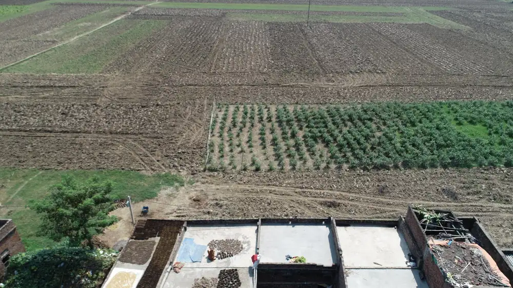
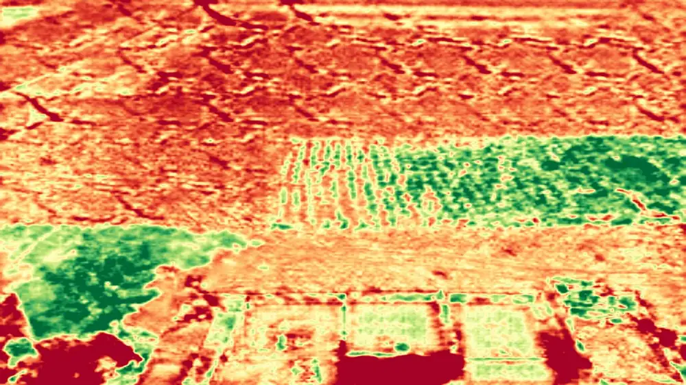
— NDVI vs RGB
NDVI vs RGB drone imagery: same decision, without the payload.
Traditional NDVI crop health mapping needs a multispectral camera that costs several times an RGB rig. The overwhelming majority of drones already flying Indian fields carry RGB cameras. Nabhya extracts a near-NDVI vegetation stress signal from the hardware you already own.
— How it works
Three steps. No new hardware.
01
Fly & capture RGB
Use the drone and camera you already own. Standard JPEG frames — no gimbal swaps, no multispectral rig.
02
Upload the frame
One HTTPS request, or drag it into the dashboard. Works from your existing flight pipeline.
03
Get crop intelligence
Vegetation stress map, management zones, and a health summary — back in seconds, as JSON or imagery.
— Who it's for
Built for the businesses that already own the flight.
Drone service providers
Sell crop health per acre
Turn every survey flight into a sellable vegetation stress report — same drone, same flight plan, a new line of revenue.
Farm management platforms
Add crop health to your software
One API call adds NDVI-grade stress mapping to your product. No hardware program, no ML team.
Agronomy consultancies
Inspect first, then spray
Ground-truth your recommendations with a stress map before prescribing inputs. Evidence the farmer can see.
— Crops
Drone crop health monitoring for India's major crops.
Vegetation stress mapping tuned for the fields Indian drone operators actually fly.
Wheat
Rabi stress scouting before irrigation calls
Paddy / Rice
Patchy establishment and nitrogen stress
Sugarcane
Vigour mapping across long-duration stands
Cotton
Early stress detection ahead of pest pressure
Grapes
Block-level vigour for targeted canopy work
— Validation
Checked against real NDVI.
Every model release is benchmarked against multispectral NDVI captures of the same fields, same day.
NDVI-correlated
Stress index benchmarked against same-day multispectral NDVI ground truth.
Seconds
From upload to stress map — measured on production traffic, not a lab demo.
Field-tested
Validated on live pilot fields with drone service providers and agronomists.
API
One endpoint. Three ways to take the result.
POST https://api.nabhya.tech/v1/analyze
Authorization: Bearer <your-key>
Content-Type: multipart/form-data

file=@block_north_0142.jpg
aoi=@boundary.geojson    # optional, raises confidence
formats=png,json,geotiff{
"vigour_mean": 0.5625,
"canopy_cover": 0.636,
"worst_zone_share": 0.1002,
"confidence": "medium",
"analysed_share": 0.9896,
"panels": ["vigour", "canopy", "excluded", "zones"]
}— FAQ
Asked first, answered straight.
No — and we say so. NDVI needs a near-infrared band. Nabhya predicts an NDVI-correlated vegetation stress index from RGB alone, validated against same-day multispectral NDVI captures. For scouting and zoning decisions, the map agrees with NDVI where it matters.
— Why Nabhya
Inspect first, then spray.
Nabhya was built in Greater Noida by an agriculture student from Munger, Bihar, who grew up watching family land split smaller with every generation. Smaller plots leave less room for error — and less money for hardware.
A multispectral payload costs several times an RGB rig, while the overwhelming majority of drones already flying Indian fields carry RGB cameras. So rather than asking operators to buy new hardware, Nabhya extracts a near-NDVI vegetation stress signal from the hardware they already own — delivered as a cloud API, so it fits into a workflow instead of replacing one.
Run your own frame through Nabhya.
Upload one RGB drone image. Judge the stress map yourself.
API pricing announced soon · No card required for the demo
Get a result
Send us one frame.
If you have a recent RGB flight sitting on a drive, send a single frame and we'll return the full result for it — free, no account. It's the fastest way to find out whether this is useful to you.
- Returned
- Vigour map, zones, canopy mask, summary
- Turnaround
- Same day, seconds of compute
- Cost
- Free during onboarding