 Nabhya
Who we serve
Built for the people who already own the flight.
Nabhya is a B2B tool. We don't sell to individual farmers — we sell to the businesses flying over their fields, and to the teams deciding where to walk next.
01
Drone service providers
You already fly the field and hand over photographs. Nabhya adds a second deliverable from the same flight — a vigour map, a canopy read and a ranked scouting list — with no new payload to buy and no second sortie.
- Vigour map and ranked zones aligned to the frames you already captured
- Panels you can drop straight into the survey report your client receives
- One API call from the pipeline you already run, or a manual upload
02
Farm management platforms
Your customers already upload drone imagery into your software. Nabhya turns it into a crop health layer you didn't have to build a model for — an API call in your backend, rendered in your own interface.
- PNG panels, JSON figures and GeoTIFF rasters to render however you like
- White-label friendly output with no Nabhya interface in the way
- Commercial licence for putting the result in front of your own customers
03
Drone manufacturers
Ship an analytics layer with the aircraft. Nabhya runs on the RGB camera already fitted, so crop vigour becomes a software feature of your product rather than a hardware upgrade your customer has to justify.
- Runs on standard RGB sensors — no NIR module, no calibration workflow
- Seconds per frame, so it fits inside an on-site review
- White-label friendly outputs and figures
04
Agronomy & input teams
Forty fields, one agronomist, one week. Nabhya gives the visit order a basis: the weakest zones within each field, ranked, before anyone gets in the vehicle.
- Worst-percentile zones to scout first, per field
- Canopy cover and excluded-area figures reported on every run
- Confidence stated with the reasons behind it
05
Estates, plantations & FPOs
A repeatable uniformity read across blocks and member fields, in the same format, week after week — so change over the season is visible rather than remembered.
- Consistent panels and figures across blocks and revisits
- Batch a full flight in one sitting
- Rooftops, tracks, water and bare soil excluded before any average is taken
What lands in the report
The same two panels, whoever you are.
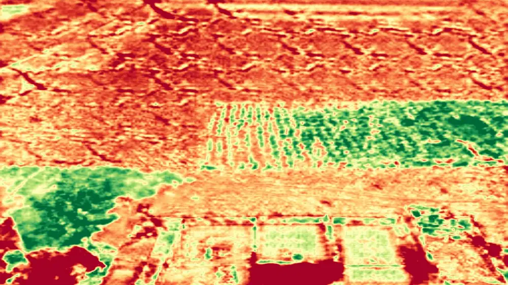 vigour map
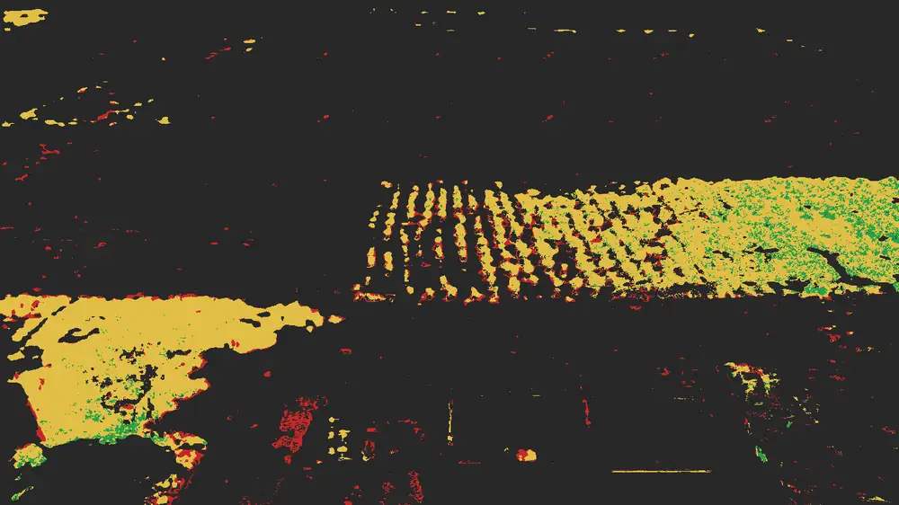 ranked zones
Get a result
Send us one frame.
If you have a recent RGB flight sitting on a drive, send a single frame and we'll return the full result for it — free, no account. It's the fastest way to find out whether this is useful to you.
- Returned
- Vigour map, zones, canopy mask, summary
- Turnaround
- Same day, seconds of compute
- Cost
- Free during onboarding