 Nabhya
NDVI from RGB
NDVI from RGB drone imagery.
True NDVI needs a near-infrared band your RGB camera does not have. Nabhya infers a near-NDVI index from visible light instead — accurate enough to rank a field against itself, and honest about the difference.
What you get
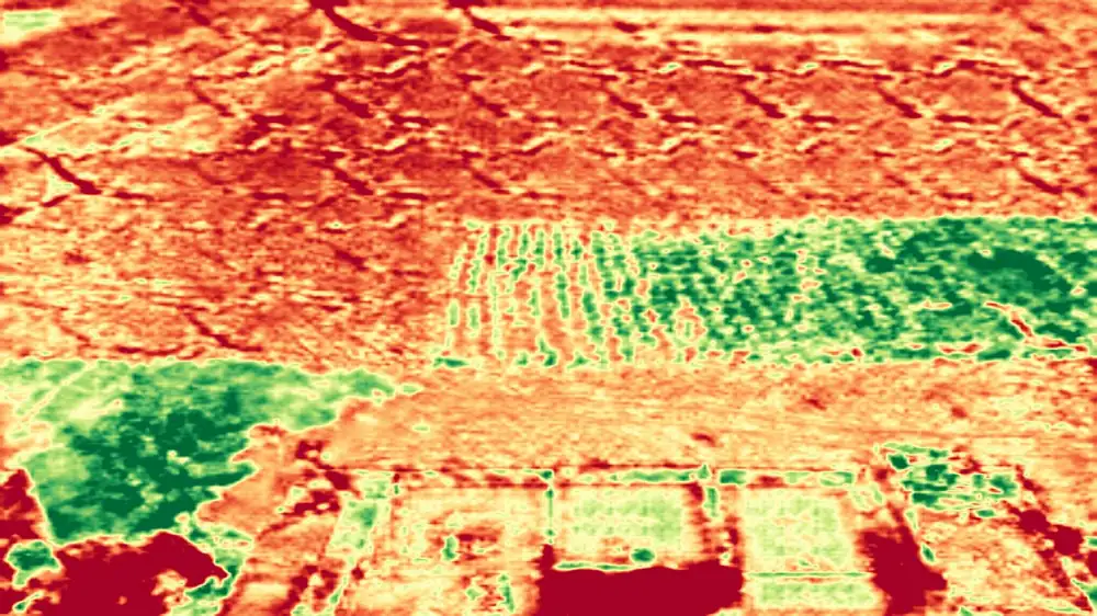 near-NDVI output
The model was trained on 2,200 paired samples — an RGB frame and the matching NDVI reference for the same scene — so it learns the mapping on identical pixels rather than on scene-level averages.
The result is a per-pixel vigour field, split into percentile management zones, with non-crop pixels segmented out and reported. It runs on CPU in about two seconds per frame.
Specification
- Index
- Near-NDVI, inferred from RGB
- Comparability
- Relative within one image
- Inference
- ≈2 seconds per frame, CPU
- Inputs
- JPG · PNG · GeoTIFF · orthomosaic
- Outputs
- PNG panels · JSON · GeoTIFF
- Not suitable for
- Calibrated cross-flight index values
Get a result
Send us one frame.
If you have a recent RGB flight sitting on a drive, send a single frame and we'll return the full result for it — free, no account. It's the fastest way to find out whether this is useful to you.
- Returned
- Vigour map, zones, canopy mask, summary
- Turnaround
- Same day, seconds of compute
- Cost
- Free during onboarding